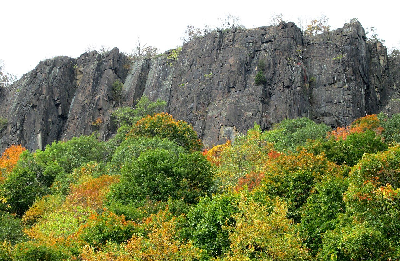
Most people meet Ramapo Valley County Reservation the same way. They pull off Route 202 in Mahwah, walk down a set of wooden steps, cross a steel bridge over the Ramapo River, and suddenly the traffic is gone. In front of them is a still, green pond. Behind it the ridge rises fast.
It's Bergen County's largest park, more than 4,000 acres on the edge of the Highlands, with about 21 miles of marked trails. Entry is free. That's part of why it gets busy, and part of why it's such a good place for a first real hike: you can stay on a flat loop around the water, or climb a few hundred feet to a rock ledge with a view across the county, and on a clear day all the way to the New York City skyline.
The trick is picking the right walk for you, and knowing what the ground is like before you get there.
Choosing a route
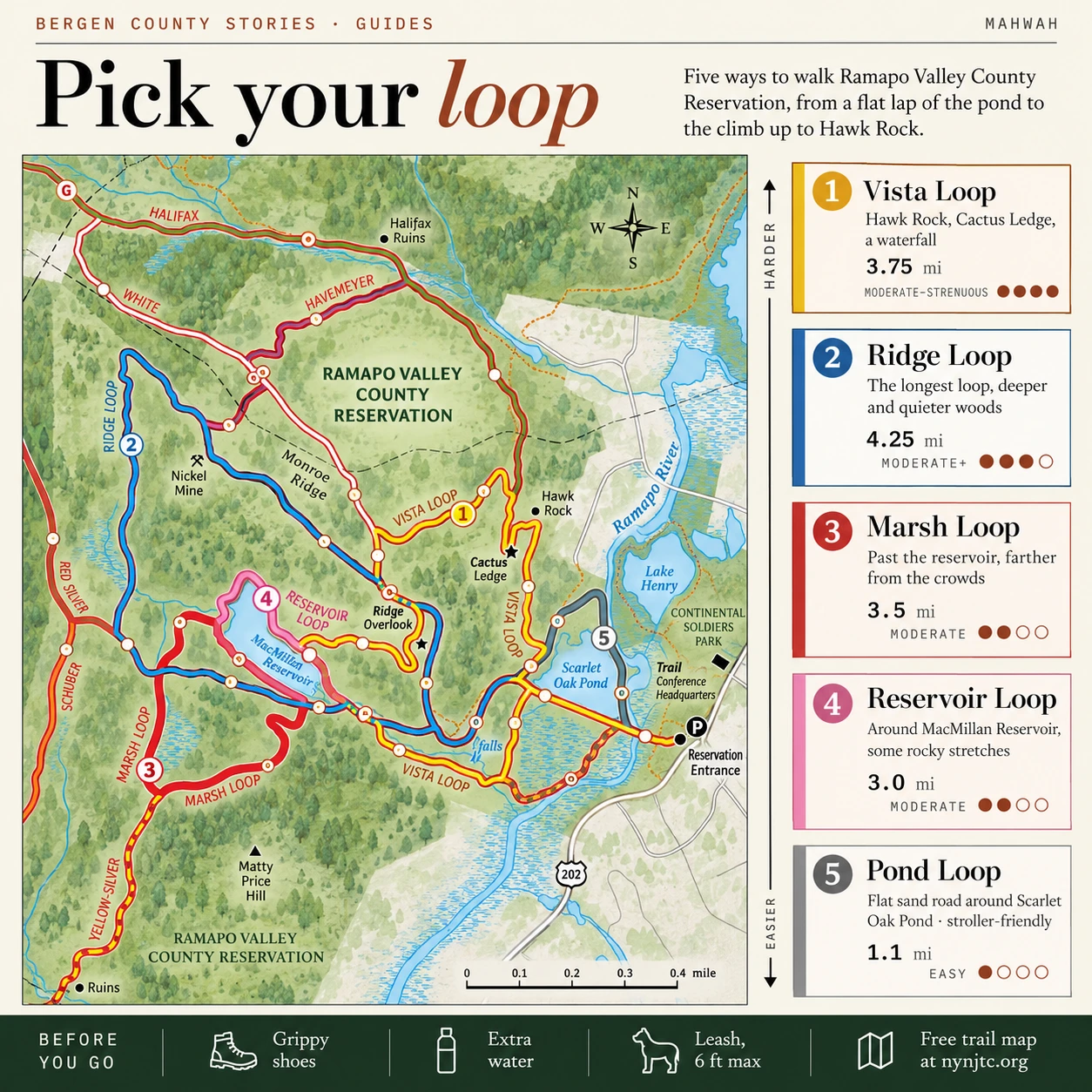
Nearly every first visit starts from the main parking lot and crosses the river bridge. From there, the trails fan out as a set of loops, each a little longer and rockier than the last. Think of them as steps on a ladder. The distances below are the New York-New Jersey Trail Conference's round-trip figures from the parking lot.
The easy one: Pond Loop, about 1.1 miles. This loop circles Scarlet Oak Pond, an old gravel quarry that's now the heart of the park. It follows a wide, hard-packed sand road, flat enough for strollers. If you're with small kids, an older dog or someone who isn't sure about hiking yet, start here. You'll still get the river, the water and the ridge above you.
A step up: Reservoir Loop, about 3 miles. Pink blazes take you up to MacMillan Reservoir, which once supplied water to the Crocker Mansion. The loop circles most of it. It's rated moderate, mainly because of rocky sections, and it's a good test of how your legs and shoes feel on uneven ground.
Longer and quieter: Marsh Loop, about 3.5 miles, and Ridge Loop, about 4.25 miles. These head deeper into the woods past the reservoir. The Ridge Loop is blazed blue, and the Trail Conference rates it "moderate plus." Choose these when you want more time on the trail and fewer people.
The classic: Vista Loop, about 3.75 miles. If you've hiked before and want the best of the park in one go, this is the one. The yellow-blazed loop climbs to Hawk Rock, a ledge looking east over Bergen County, Scarlet Oak Pond and Lake Henry. It keeps climbing to Cactus Ledge, about 400 vertical feet above the start and named for the prickly pear cactus that grows on the rock. From there, on clear days, you can see the Manhattan skyline. On the way down it passes an overlook above MacMillan Reservoir, then follows the brook below the dam past a small waterfall and cascades. Plan on roughly two and a half hours. The Trail Conference recommends walking it counterclockwise and rates it moderate to strenuous, because the climbs are steep.
For experienced hikers, longer trails continue past the core loops, into Camp Glen Gray and on toward Ramapo Mountain State Forest and Ringwood State Park. Save those for a later visit, with a map in hand.
Preparing for the terrain
Don't let the easy start fool you. Past the pond, Ramapo is Highlands country: rock outcrops, loose stones, roots, and short climbs that are steeper than they look from the bottom. The climb to Cactus Ledge on the Vista Loop is a steady, rocky pull, and the way down includes a long run of stone steps beside the brook. Those steps were built by an AmeriCorps trail crew in 2017 and 2018, and they're a big improvement on what was there before. They're still steps, though, and they get slick when wet.
A few things make the day easier:
- Shoes with real grip. Sneakers are fine for the Pond Loop. For anything with rocks, wear hiking shoes or trail runners. Smooth soles slide on wet stone, and after rain, or once the leaves fall in October and November, much of the ground is wet stone.
- Water and a snack. Even the shorter loops take longer than the mileage suggests, because rocky ground slows you down. Bring more water than you think you'll need, especially in summer.
- Time to spare. Plan a daylight visit and follow the opening and closing times posted at the entrance. In late fall, daylight runs out early. Start a long loop by early afternoon and leave time to return before the posted closing time, so you aren't coming down the steps in the dark.
- A charged phone with the map loaded. Blazes are painted on trees and rocks, and they're easy to follow, but several trails have been rerouted and recolored in recent years. A map you can check on the trail helps more than one you looked at in the car.
- A leash for your dog. Dogs are welcome, and Ramapo is one of the most popular dog-walking spots in the area. County rules require a leash no longer than six feet, and you have to bag and bin what your dog leaves behind.
Black bears live in the Ramapo Mountains. You may never see one, but it's worth reading NJDEP's bear safety tips before you go. The short version: make noise, keep food packed away, give a bear plenty of room, and never run.
A few things aren't allowed. Swimming and wading are not permitted here, so the pond and the river are for looking at. Bikes aren't allowed on the paths, and neither is alcohol. Flying a drone needs a permit. Fishing is catch-and-release only. New Jersey residents ages 16–69 and nonresidents age 16 or older generally need a state freshwater fishing license; check NJDEP for exceptions and any required trout stamp.
Finding current maps and notices
Trails here change more often than you'd expect. The Trail Conference, the volunteer group that maintains the paths, has rerouted and renamed several of them in the last few years. Some trails now carry new blaze colors, and the Silver Trail is no longer blazed from the parking lot. Older guidebooks and printouts can steer you wrong, so check these before you leave home.
The Trail Conference's free map. The TC-Ramapo Valley Reservation Map is a free PDF download from nynjtc.org. The same map works in the free Avenza Maps app, which shows your position on the map even without a cell signal. If you'd like a paper copy that survives rain, the Trail Conference sells a waterproof Tyvek version. Its headquarters is in the old Darlington Schoolhouse at 600 Ramapo Valley Road, just 0.1 mile before the park entrance.
The Trail Conference's park page. This page lists every trail with its blaze color, length and difficulty, and notes recent changes. Its trail alerts page posts closures and reroutes.
The county's park page. Bergen County's Department of Parks page for the reservation has the official trail map, a campground map, and links to the parks rules and the permits and fees page. Use the county's trail map for a general picture. The Trail Conference map is the more up-to-date one for blazes.
The trailhead kiosk. At the southwest corner of the parking lot, the kiosk marks the start of the trails. It's worth a look for posted notices before you head down the steps.
A phone call. If the weather has been rough, or you're planning something longer, call the reservation at 201-327-3500. For trail sketch maps, call 201-634-3140.
Practical details
Getting there. The entrance is on Ramapo Valley Road (Route 202) in Mahwah. The Trail Conference lists the main parking area at coordinates 41.077886, -74.186052; check the official park directions before setting out. From Route 17 north, take the Route 202 exit, turn left at the bottom of the ramp, and drive about 2 miles south. The lot is on the right.
Parking. The main lot rarely fills on weekdays. On sunny weekends you may have to wait for a space by midday, so arrive early. Don't park at the church on Darlington Avenue, and the Trail Conference asks hikers not to use its small lot either. Two other options:
- Continental Soldiers Field, which has a paved sidewalk to the reservation. Its Lake Henry has an easy one-mile loop of its own. Follow the current parking signs.
- Ramapo College's South Gate, listed by the Trail Conference as an alternative for weekend hiker parking. Follow current campus signs and restrictions. A traffic light helps you cross Route 202.
By bus. Ramapo College lists a Coach USA/ShortLine route between campus and the Port Authority Bus Terminal, about half a mile from the reservation entrance. Check the current outbound and return schedules before traveling, especially on weekends.
Hours and cost. Plan a daylight visit and follow the posted park hours. The county rules include a sunrise-to-sunset schedule, with specific opening and closing times subject to posted notices. Entry and parking are free.
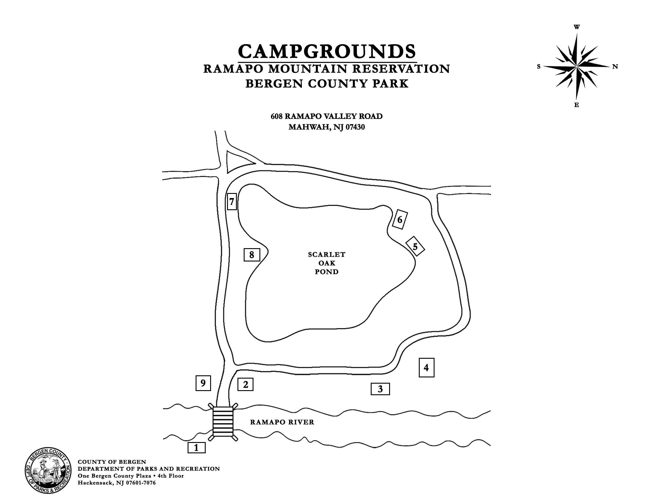
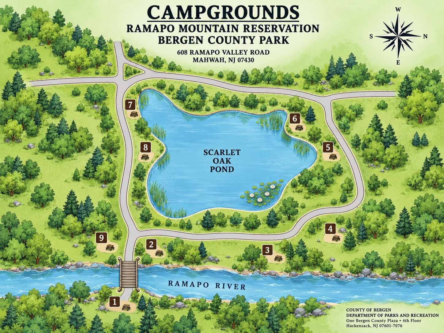
Camping. Tent camping is allowed only at the designated sites around Scarlet Oak Pond, from April through November, and needs a county permit.
Contact. Ramapo Valley County Reservation: 201-327-3500. Bergen County Parks: 201-336-7275.
Information checked October 2026. Trails, blazes and rules change, so check the latest map and the park's notices before you go.
Sources
- Bergen County Department of Parks — Ramapo Valley County Reservation (park overview, camping and contacts).
- Bergen County Parks System Rules & Regulations (current PDF linked by the county; posted notices govern local hours).
- New York-New Jersey Trail Conference — Ramapo Valley County Reservation (loop distances, terrain and parking).
- Trail Conference — free Ramapo Valley Reservation map and trail alerts.
- NJDEP — Bear Encounters and freshwater fishing license requirements.
- Ramapo College — public transportation (current route and schedule links).
- Daniel Chazin, “Hike the Vista Loop Trail in Ramapo Valley County Reservation,” The Jewish Link, June 5, 2025 (viewpoints, climb and stone steps).